


The Scenery at Kasa Cape Begins on the Path to the Lighthouse
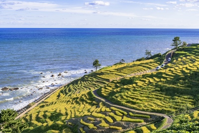
Kasa Cape in Kaga City, Ishikawa Prefecture, is a place where you can see both the landform projecting into the Sea of Japan along the Kaga Coast and the white Kasa Misaki Lighthouse standing near the tip.
Instead of making only the tip of the cape your destination, follow the transition from the tree-lined path to the opening sea and sky, and even a short walk takes on a story of its own.
Coastal scenery changes dramatically with the weather and wind, so observe the conditions on the day you arrive and choose a route that does not overextend you.
Notice Changes in Light and Wind among the Trees
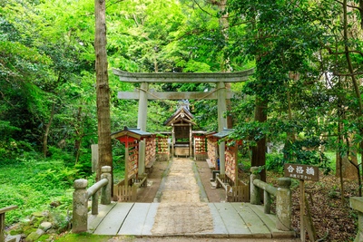
Near the entrance, first check your footing, then notice the light and shade among the trees and the direction in which the leaves are moving.
Even where the sea is still difficult to see, brighter light and the sound of the wind provide clues that help you sense your approach to the cape.
Rather than hurrying through, stop in a safe place and compare the views ahead and behind to appreciate the gradual shift from forest to coast.
Use the White Lighthouse as a Landmark along the Path
As the view opens up, the white lighthouse contrasts with the colors of the sky and sea.
Instead of viewing only the lighthouse up close, layer it with the trees and path in the foreground and the horizon beyond to better imagine why it stands here.
Part of the nature trail is closed because of a collapse at the tip of the cape.
Always follow local signs about access and do not go beyond fences or restricted areas.


Read the Shape of the Cape Projecting into the Sea of Japan through 3 Lines
The view of the cape becomes easier to understand when divided into 3 lines: the horizon separating sea and sky, the cliff line defining the land, and the vertical lighthouse.
Because each runs in a different direction, they make it easier to decide where to focus within the expansive view.
Observe the Horizon by Changing Its Height in the Frame
Placing the horizon in the center gives equal space to sea and sky, while lowering your viewpoint slightly emphasizes the relationship between the water and rocky reefs.
On a day with striking clouds, include more sky; when wave patterns are visible, give more space to the sea, adjusting your view to the day's conditions.
Long-distance visibility depends on the weather, so do not assume that a particular mountain or region will always be visible; enjoy the boundary you can see now.
See the Cliff Line as a Contour Carved by the Sea
Where land and sea meet, look at the color of the rock, its cracks, and the extent of the vegetation.
Looking down from above can distort your sense of distance, so trace the contour from a maintained viewing area rather than approaching the cliff edge.
Comparing the rocks reached by the waves with the vegetated slopes reveals how the environment changes continuously even within the same cape.
| Scenic line | What to notice | How to view it safely |
|---|---|---|
| Horizon | Colors of the sea and sky, layers of clouds | View the distance from a place where you can stop safely |
| Cliff line | Rock surfaces, vegetation, and the reach of the waves | Observe from maintained areas without approaching the cliff edge |
| Vertical lighthouse line | Contrast between the white exterior and surrounding colors | Include it in the full view from a position that does not obstruct passage |


Consider How Kasa Misaki Lighthouse Supports Maritime Traffic
Kasa Misaki Lighthouse is a white lighthouse standing atop the cliffs of Kasa-no-Misaki.
From land it appears to be part of the scenery, but it also serves as a navigational aid that signals location to ships traveling at sea.
View the Lighthouse in Relation to the Sea, Not as an Isolated Building
Observe not only the shape of the white tower but also the direction it faces toward the sea and whether any tall obstacles surround it.
Recognizing that the lighthouse stands on a projecting cape helps you consider the difference between a landmark seen from land and its appearance from the sea.
For details about the light and equipment, consult guidance from the relevant specialist authorities and avoid guessing about performance that cannot be confirmed from the exterior.
Combine the Lighthouse's White Exterior with Seasonal Colors
When the surrounding greenery is dense, the white exterior stands out; when there are fewer leaves, the tower's outline and boundary with the sky become easier to see.
Observation is rewarding not only in clear weather but also in the soft light and shade of cloudy days and in the changing light as clouds move.
Do not touch the building or enter areas near the equipment; observe the relationship between color and form only from permitted locations.


Set a Safe Range by Reading the Wind and Waves
With few barriers at the cape, the wind may feel strong, and even when the sea appears calm, sudden gusts and changing footing require attention.
Do not rely only on the forecast before your visit; reassess the wind, path surface, waves, and visibility on site.
Check the Wind through Both Tree Movement and How It Feels
If branches and leaves are swaying strongly, you feel your body being pushed, or your hat and belongings seem likely to blow away, decide not to continue toward the tip.
Use a bag that makes it easy to keep both hands free, and secure hats and fabric items so the wind cannot carry them away.
In strong winds, do not keep your attention fixed on the camera screen; steady your posture and return to a safe place.
Avoid Wet Surfaces and Cliff Edges
When rain or sea spray wets the ground, soil, fallen leaves, and stones become slippery.
Choose comfortable shoes with treaded soles, and check where you place each foot 1 step at a time at every change in level.
Do not lean out even where there is a fence, and never enter a dangerous area to retrieve something you have dropped.
| Conditions on site | Possible hazard | Suggested action |
|---|---|---|
| Strong wind | Falls and belongings blowing away | Do not continue to the tip; return to a place sheltered from the wind |
| Wet surface | Slipping on soil or fallen leaves | Take smaller steps and avoid steep areas |
| Poor visibility | Losing sight of the boundary between cliff and path | End your observation and move to a brighter area |


Balance the Cape's Expansive Photos with Consideration for Passage
At Kasa Cape, photographic subjects include not only compositions centered on the lighthouse but also the moment the sea appears from the path and the layers of rocky reefs and waves.
Choose a safe shooting location before considering composition, and leave enough width for other people to pass.
Limit the Foreground to 1 Element in Wide-Angle Shots
A tree branch, the edge of the path, or a rock surface in the foreground can add depth, but including too many elements makes the subject unclear.
Center the composition on 1 of the lighthouse, horizon, or path, and use the others as supporting elements that explain the setting.
Even while taking photos, do not keep your back turned only toward the sea; regularly check the people around you and movement near your feet.
Remember That Telephoto Lenses Compress Distance
When cliffs or waves are photographed with a telephoto lens, they may appear closer together than they really are.
Do not move to a dangerous position while waiting for waves to strike the cliffs; adjust the composition with focal length from a safe place.
If people appear in the frame, respect their privacy and avoid occupying 1 spot for a long time.

Plan a Comfortable Tour of the Kaga Coast
Around Kasa Cape are places where you can experience coastal scenery and the local culture of Hashitate, but packing too much into one trip can reduce your attention to footing and weather.
Make observation at the cape the focus and leave flexibility in the plan for travel time and breaks.
Access and Parking for Kasa Cape
Kasa Cape is in Hashitate-machi, Kaga City, Ishikawa Prefecture, about 6.6 km from the Katayamazu Interchange on the Hokuriku Expressway and about 8.7 km from Kagaonsen Station.
By public transportation, take the coastal route of the Kaga Loop Bus CANBUS from Kagaonsen Station, then walk from the nearest bus stop to the cape.
Parking is available, but the accessible sections of the trail may change, so check information from Kaga City or a tourist information service before departure.
Decide Your Arrival and Departure Times in Advance
The scenery changes around sunset, but steps and path boundaries also become harder to see.
Set a time that allows you to return while it is still light, and leave early if the weather appears likely to worsen.
Access, parking, and public transportation conditions may change, so check information from Kaga City or a tourist information service before departure.
Remember 1 Change You Discover at the Cape
Rather than visiting many points, you can carefully observe 1 change, such as the moment the view opens from the trees to the sea, the white lighthouse against the clouds, or the movement of waves reaching the rocky reefs.
Briefly recording the order of what you noticed also helps organize memories of wind and sound that photographs alone may not preserve.
Leaving nature as it is and not taking plants or stones home are also basic ways to preserve the scenery for the next visitor.
Summary | Enjoy the Changes between Path and Sea at Kasa Cape
Kasa Cape is a place where different elements unfold in sequence: a tree-lined path, the white Kasa Misaki Lighthouse, and the cliff line projecting into the Sea of Japan.
Following the 3 lines of horizon, cliff, and lighthouse in order makes it easier to take in the broad scenery calmly.
Above all, check the wind, surface, and visibility on site, stay away from cliff edges and restricted areas, and observe only from safe locations.
Leave room to adjust your plans to the weather, and take time to appreciate the fleeting light and waves visible that day.


Reviews (0)