


What Is the Nikkō Cedar Avenue? Planning a Scenic Walk
To enjoy a walk along the Nikkō Cedar Avenue (Nikkō Suginamiki Kaidō), choose a section of this approximately 37 km route, then pause and change your viewpoint to appreciate the rows of cedar trunks.
Narrowing down your walking area and paying attention to the trees and the way the roads connect will give your stroll a clearer focus.
The History and Approximately 37 km Length of the Nikkō Cedar Avenue
The Nikkō Cedar Avenue is said to have begun when Matsudaira Masatsuna, a retainer of Tokugawa Ieyasu, and his son Masanobu planted cedars over more than 20 years starting in 1625, the second year of the Kan'ei era, and donated them to Nikkō Tōshō-gū Shrine.
The avenue follows three historic roads, the Nikkō Kaidō, Reiheishi Kaidō, and Aizu Nishi Kaidō, through Nikkō and Kanuma in Tochigi Prefecture, stretching approximately 37 km in total.
There are about 12,000 cedars along the avenue, which marked 400 years since planting began in 2025.
Under the designation Nikkō Cedar Avenue and the Monuments Commemorating Its Donation, it is both a national Special Historic Site and a Special Natural Monument, the only place in Japan with this dual designation.
It is also recognized by Guinness World Records as the world's longest tree-lined avenue.
Choose the Scenery You Want to See Rather Than a Distance to Cover
On a first visit, rather than aiming for a long walk, look for details that interest you, such as the avenue's sense of depth or the character of individual trunks.
Walking the entire approximately 37 km route in one go is difficult, so choosing a section of around 1–3 km to start with gives you time to appreciate the scenery.
Allow roughly 15 minutes per kilometer, and more if you plan to take photos along the way.
Build in time to stop if you want photos, or time to match your companions' pace if your priority is spending time together.
Even when combining the walk with other sightseeing, leave room to enjoy the views rather than filling your schedule with travel alone.
Explore the Three Historic Roads: Nikkō Kaidō, Reiheishi Kaidō, and Aizu Nishi Kaidō
Kaidō is a Japanese term for a road connecting towns or regions.
The Nikkō Cedar Avenue comprises three roads: the Nikkō Kaidō, running from the Utsunomiya area through Imaichi to Nikkō; the Reiheishi Kaidō, used by imperial envoys carrying offerings to Nikkō Tōshō-gū; and the Aizu Nishi Kaidō, leading north from Imaichi toward Aizu.
Oiwake Jizōson, a statue of the Buddhist figure Jizō, stands at the junction in Imaichi where the Nikkō Kaidō and Reiheishi Kaidō meet.
As well as looking at the cedars on their own, notice which way the road stretches and how the trees follow it to appreciate the avenue and road together.
Where explanatory panels are provided, checking the place names and road names as you walk helps connect the information with the landscape.
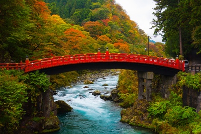
Monuments commemorating the donation of the avenue, erected in 1648, the first year of the Keian era, to mark the completion of planting, also remain near places such as Shinkyō Bridge in Nikkō.


Choose Your Nikkō Cedar Avenue Walk Around the Starting Point and Return Route
Planning a walk along the Nikkō Cedar Avenue is easier if you decide where to start and finish before looking up transportation.
Start Your First Walk at Suginamiki Park Near Kami-imaichi Station
For a first visit, starting at Suginamiki Park, a park along the Nikkō Kaidō in Segawa, Nikkō, makes planning easier thanks to its location near the station.
Suginamiki Park is just outside Kami-imaichi Station on the Tobu Nikko Line.
By car, it is about 3 minutes from Imaichi Interchange on the Nikkō Utsunomiya Road, with free parking along National Route 119 and near Kami-imaichi Station.
In the Imaichi area, known for producing cedar incense, waterwheels powered manufacturing; in the park, you can also see waterwheels turning that were used for tasks such as pounding rice and milling flour.
The former Ezure family residence, built in 1830, has been relocated and preserved here and is open free of charge from 10:00 a.m. to 4:00 p.m., except from December 29 to January 3.
There is also a reconstructed farmhouse originally built under the Hōtoku Shihō rural reform program of Ninomiya Sontoku, which now operates as a restaurant serving soba (buckwheat noodles).
Since the park runs along the cedar avenue, an easy approach is to walk through the park and nearby trees first, then continue toward Nikkō or Imaichi if you would like to go farther.
Start at Oiwake Jizōson When Arriving at JR Imaichi Station
If you use the JR Nikko Line, Oiwake Jizōson, about a 5-minute walk from Imaichi Station, lets you start at the junction of the Nikkō Kaidō and Reiheishi Kaidō.
Beyond the junction, the road you follow depends on the direction you take, so check a map to decide which avenue you want to see before setting out.
Check the Exact Section You Want to Walk on a Map
Rather than simply searching for the destination name and heading out, make sure the position shown on the map matches the cedar avenue you want to see.
Because the Nikkō Cedar Avenue extends along several historic roads, checking the road name, such as Nikkō Kaidō or Reiheishi Kaidō, makes it easier to find the stretch you want to walk.
Compare your route with a tourist map and check how to get from your arrival station or stop to your walking starting point.
If Japanese place names are difficult to read, saving the destination name and map can help when asking for directions.
For example, keep a note of the Japanese kanji spellings: Suginamiki Park (杉並木公園), Kami-imaichi Station (上今市駅), and Oiwake Jizōson (追分地蔵尊).
Choose Routes Open to Pedestrians
A continuing row of cedars does not necessarily mean you can keep walking along the same route.
Check road signs and local information to distinguish places open to pedestrians, sections used by vehicles, and areas where entry is prohibited.
To help protect the cedars and for other reasons, some sections of the old roads have been closed to vehicles following the opening of bypasses and are now pedestrian-only.
Pedestrian-only sections include approximately 800 m of the old road by the Mizunashi Bypass and about 0.4 km east of the Shichihonzakura intersection on the Nikkō Kaidō, plus approximately 1.0 km between Myōjin and Itabashi in Nikkō on the Reiheishi Kaidō.
Since these sections are closed to vehicles, they are good options for taking your time to admire the avenue.
Even if a map shows a continuous road, do not proceed farther if you cannot confirm where it is safe and permitted to walk; reconsider your route instead.
On sections with vehicle traffic, check the width of the sidewalk or shoulder and pay attention to passing vehicles as you walk.
Share Your Return Transportation Plans and Meeting Point
If using public transportation, check not only where you will arrive but also the station or bus stop you will use for the return journey.
Around Imaichi, there are Kami-imaichi and Shimo-imaichi stations on the Tobu Nikko Line and Imaichi Station on the JR Nikko Line, so choosing a station near your walking endpoint makes the trip back easier.
If you may separate from your companions to take photos, share the following information before setting out.
- Where to meet after the walk
- How to contact one another if plans change
- Which transportation to use for the return journey and where to board


Things to See Along the Nikkō Cedar Avenue: Change Your Viewpoint
Even in the same spot, the view changes depending on whether you look down the road, at the trunks, or overhead.
Rather than continuing to look up as you walk, check your surroundings and footing before stopping to observe.
Notice the Layers of Trunks Stretching into the Distance
Paying attention to how the trees in front overlap with those farther away makes it easier to appreciate the avenue's depth.
As well as looking straight down the road, try viewing it diagonally from a place where you will not block anyone to notice differences in the spacing of the trunks and the overlapping branches.
Sharing interesting shapes with your companions can also encourage you to slow down and look more closely.
Compare the Character of the Trunks and the Glimpses of Sky
You can observe bark patterns and the outlines of the trunks without touching the trees.
After focusing on a nearby trunk, look at the sky between the branches to compare the details with the overall scene.
Enjoy the differences in light and shadow as you find a view you like.
Cedars sponsored through the conservation ownership program may have owner's plaques, so looking for these is another way to enjoy your walk.
Look for Named Trees and Slopes, Including Sakura-sugi and Hōdan Uchikomi-sugi
The Nikkō Cedar Avenue has trees and slopes named after their appearance or history, and looking for them adds variety to a walk.
Near the Moritomo district on the Nikkō Kaidō toward Utsunomiya is the unusual Sakura-sugi (Cherry Blossom Cedar), a cedar living together with a cherry tree that grew from a crack in its trunk.
Nearby is Namiki Hotel, a large cedar with a hollow at its base big enough for around 4 adults.
Along the Nikkō Kaidō is Hōdan Uchikomi-sugi, a cedar said to have been struck by a cannonball during a preliminary clash of the Boshin War in 1868.
Jikkoku-zaka on the Reiheishi Kaidō is a steep slope that made transporting Tōshō-gū's large stone torii shrine gate difficult; its name is said to come from the 10 koku of rice, a traditional measure of volume, needed to feed the workers.
Jishin-zaka, also on the Reiheishi Kaidō, takes its name from the 1949 Imaichi earthquake, which changed the shape of the road along with the cedar avenue.
Even when you find a named cedar, do not enter its hollow or climb its trunk; admire its exterior from a place where you will not obstruct others.


Nikkō Cedar Avenue Photography Tips: Position and Composition
When taking photos, the basic approach is to first choose a position where you will not block others, then consider the compositions available from that spot.
Choose Your Framing to Match the Impression You Want to Capture
The area you include in the frame will differ depending on whether you want to show the height of the trunks or the road stretching into the distance.
Rather than trying to fit an entire tree into the frame, deciding on your main subject helps give the photo a clear focus.
Shooting from a distance with the telephoto end of a zoom lens makes the trunks farther away appear closer together, emphasizing the avenue's density.
Using a wide-angle view to include the line of the road edge diagonally as it stretches into the distance helps convey the avenue's length.
Here are some ways to match the impression you want to capture with a suitable composition.
| What to Capture | Composition Tip | What to Include |
|---|---|---|
| The height of the trees | Hold the camera vertically | Trunks and overhead branches |
| The depth of the road | Use lines leading into the distance | The road and overlapping trunks |
| The character of the bark | Frame part of a pattern | The trunk's outline, light, and shadow |
Look Around Before Changing Position
Do not step backward while looking at the screen or move into the roadway to take photos.
Where people need to pass one another, pause your photography and leave room for them.
If a passerby would appear prominently in the photo, change your angle or wait for them to pass.
On sections with vehicle traffic, do not position yourself partly in the roadway or stop in the middle of the road.
Follow Local Guidance on Photography Equipment
If you want to use a tripod or similar equipment, check the permitted locations and conditions in advance and follow any guidance posted on site.
Sunlight may struggle to reach parts of the avenue beneath the tall cedars, so hold your camera steady to prevent camera shake and reconsider the exposure settings.
If unwanted branches or grass enter the frame, change your angle rather than breaking or moving them.
After taking photos, move to a place where you will not block the path before reviewing them.


What to Wear and Bring for a Nikkō Cedar Avenue Walk
Choose comfortable, familiar shoes and clothing that allows easy movement, and check the weather forecast before setting out.
Avoid carrying too much, and pack your belongings so that your hands are free to make walking easier.
Adjust Your Plans to the Ground Conditions
On wet ground, fallen leaves, and uneven sections, pay attention to your footing as well as the scenery.
If using a stroller or wheelchair, ask in advance about the surfaces and changes in level along your intended section, then choose a suitable route.
If the forecast changes or walking feels difficult when you arrive, consider turning back rather than insisting on completing your planned route.
Choose What to Carry According to the Temperature and Rain Forecast
Adjust your preparations to the day's temperature and rainfall forecast rather than relying on the name of the season alone.
Think about both what to bring for the weather and how to adapt your walk.
| Expected Weather | What to Bring | Walking Tip |
|---|---|---|
| A hot day | Drinks and a hat | Take breaks |
| A day with rain forecast | Rain gear and a towel | Watch your footing on wet ground |
| A day likely to turn chilly | A jacket you can adjust or remove | Head back before you get cold |
When stopping for a break or taking things out of your bag, choose a place away from other people's path.
For a longer walk along the avenue, locate toilets and places to rest on a map before departure, and use facilities at a station or park before you start.

Etiquette for Protecting the Nikkō Cedar Avenue
When admiring the trees, avoid putting strain on the trunks and roots, and be considerate of people passing through or living nearby.
Why the Number of Cedars Keeps Declining
The 16,479 cedars recorded when the avenue register was compiled in 1961 have decreased by more than 4,000 over a little more than 60 years.
Major causes include the trees' age, natural disasters such as typhoons, increased vehicle traffic, and a worsening growing environment due to development around the roads.
Tochigi Prefecture has a program in which sponsors purchase a cedar for 10 million yen to become its owner; the money is managed in a fund, with investment returns used for conservation work such as restoring tree vitality.
Since increased vehicle traffic is also considered a factor, parking your car and enjoying the avenue on foot is recommended over driving through it just to see the trees.
Stay Off the Roots and Leave Plants Where They Are
Do not stand on roots for photos or put your body weight on branches or trunks.
Where fences or marked boundaries are provided, stay outside them and observe from the designated places.
Rather than taking flowers, plants, or bark as souvenirs, capture the features that interest you in photos or words.
Be Considerate About Trash and Noise
It is useful to bring a small bag for taking drink containers, wrappers, and other trash home.
Avoid taking over the path while absorbed in conversation or photography, and keep your voice down near homes.
It is also important not to use private property or the space in front of buildings for breaks or photography without permission.
Plan a Relaxed Walk Along the Nikkō Cedar Avenue
For a walk along the Nikkō Cedar Avenue, first choose a section, such as the area around Suginamiki Park or a pedestrian-only stretch, and plan your return route, then follow local guidance.
Keeping in mind what you want to see, whether the road's depth, the character of the trunks, or named cedars such as Sakura-sugi, helps you appreciate the scenery as you walk.
Be considerate of the trees and the people around you, and enjoy a manageable walk suited to the weather and your energy level.



Reviews (0)